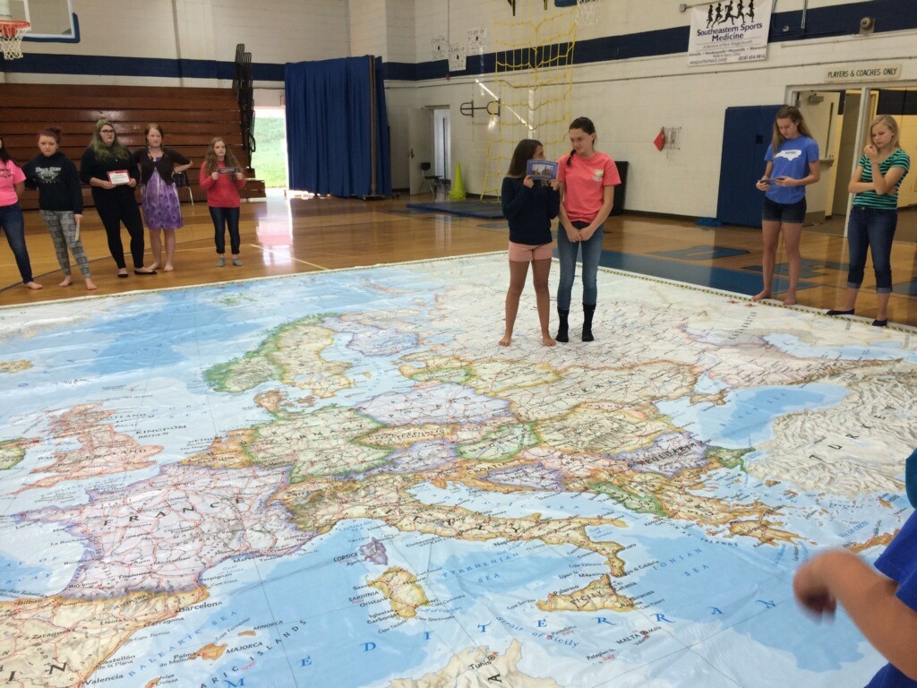
Bethel Middle School students have finished testing and their teachers want them to have rich, educational experiences that are fun and engaging, right up until the last bell rings! So what do you do? Experience the world through a half court-sized map of Europe on which students can explore, travel from country to country, hop around, compete, collaborate, and have lots of fun!
That is what is happening at Bethel Middle School and Waynesville Middle School with a National Geographic Giant Traveling Map. What better way to learn the power of maps and the limitless depth of geography than with activities like “The Grid Game” and “Venn There, Done That”, where students work collaboratively to complete a variety of tasks.
The Giant Traveling Map is the largest map ever produced by National Geographic and it requires a school gym or media center for use. Bethel Middle and Waynesville Middle School have both chosen the map of Europe because of the close global ties and related curriculum. The activities allow students to discover a part of the world from which many of our ancestors came, and provide them with opportunities to analyze population growth, and explore historical sites, without leaving the school! The map creates an atmosphere where kids aren’t just looking at a map but they are on the map! They are exploring it, walking on it, crawling on it, running on it, and having a great time learning!
Submitted by: Carol Douglas, Middle School Supervisor